Canopy cutaway search guide
The Canopy Cutaway tool gives a forecast-based search estimate from a selected cutaway point, cutaway altitude, time, canopy condition, and optional ground spotter azimuths.
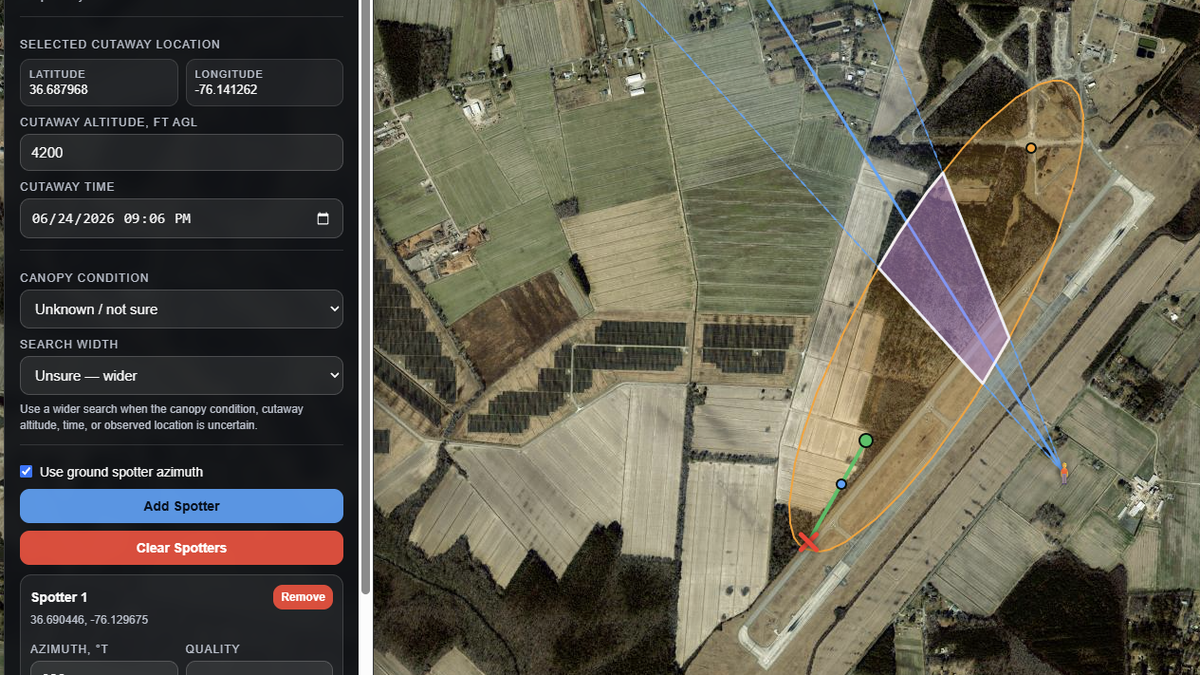
What the tool reviews
The tool reviews a selected cutaway location, estimated cutaway altitude, forecast wind layers, selected time, canopy condition, and any entered spotter bearings. It then displays a map-based estimate that can be compared with known terrain, roads, fields, property boundaries, and observer reports.
Inputs that matter most
Cutaway altitude, location, time, canopy condition, and search width have the largest effect on the displayed area. If any of those values are uncertain, use wider settings and treat the result as a broad planning reference.