Weather forecast
The weather forecast tool displays meteorological forecast data over time in a single comprehensible chart. The chart is color coded to highlight trends that may be uncomfortable or risky.
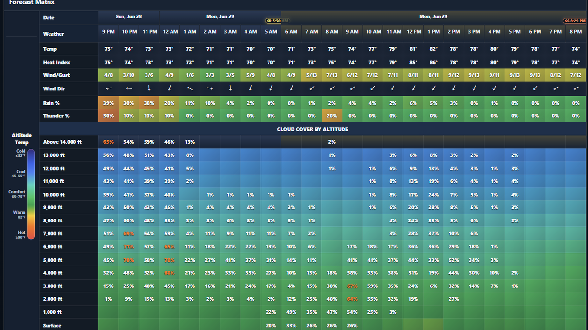
What the chart is intended to show
The chart brings multiple forecast variables into one view so skydivers can review changes over time. It is useful for comparing wind and gust trends, rain or thunder potential, temperature, heat index, and cloud coverage across altitude rows.
Altitude and cloud awareness
Altitude rows are forecast reference levels. True AGL, barometric altitude, and model altitude levels can differ, so cloud and temperature information should be interpreted as planning awareness rather than a direct substitute for aviation weather sources or local observations.